-
×
![Terciopelo [Audio CD] Muza](https://musicelle.com/wp-content/uploads/2023/01/woocommerce-placeholder-163-324x324.png) Terciopelo [Audio CD] Muza
1 × $7.88
Terciopelo [Audio CD] Muza
1 × $7.88
Subtotal: $7.88
Terciopelo [Audio CD] Muza
1 × $7.88 Subtotal: $7.88
$18.77
1 in stock
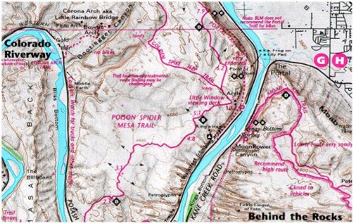
Map Coverage covers all or part of 36 USGS 1:24,000 7.5-minute topographic maps
Size
Scale 1:75,000; 1 inch = 1.2 miles or 1.9 km
Contour Interval 80 feet with shaded relief base
Latest Edition 3rd –
Back Side


Reviews
There are no reviews yet.